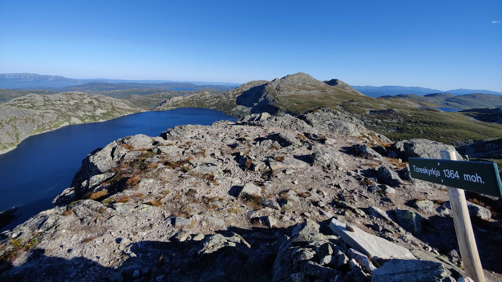
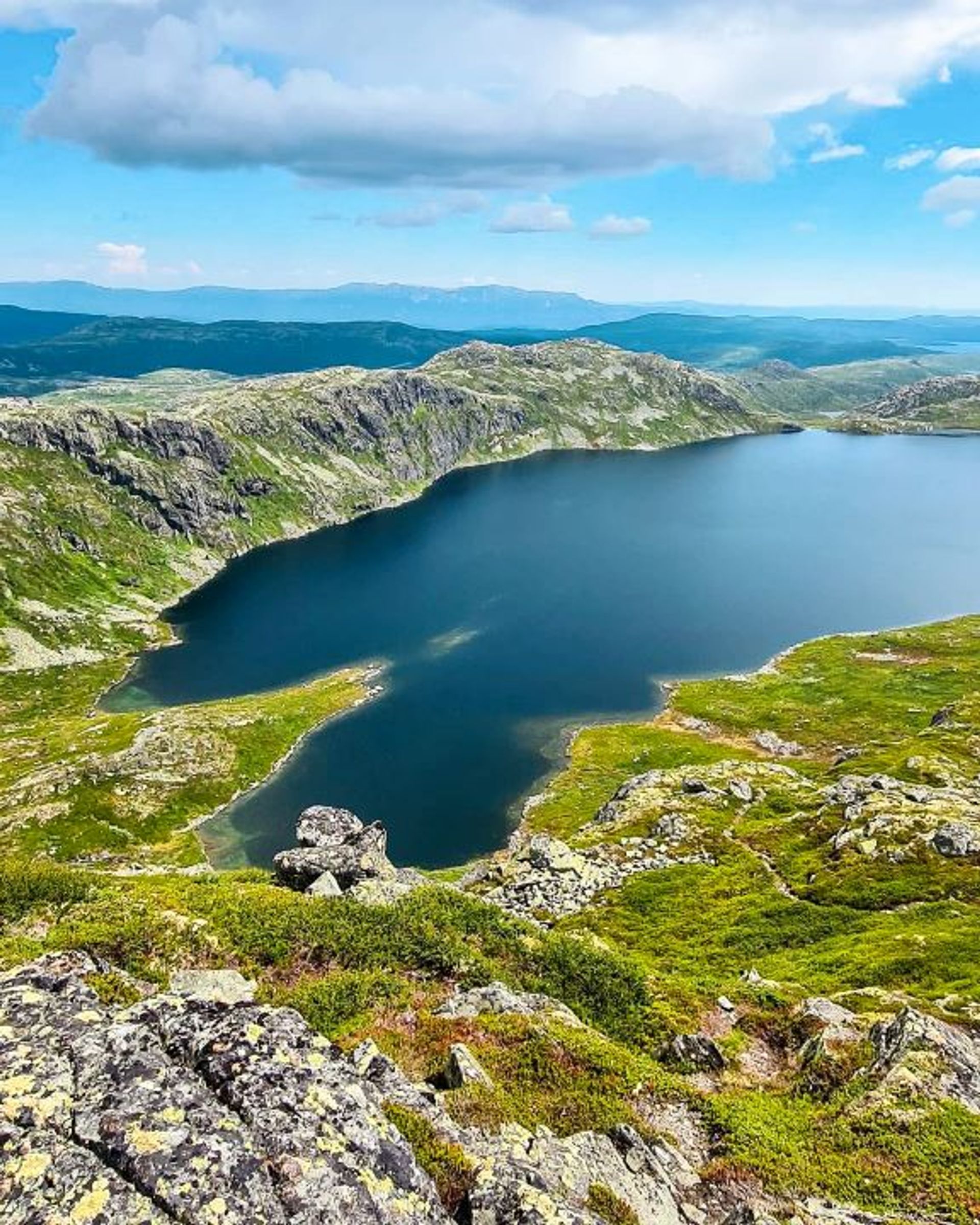
Hike to Toreskyrkja fra Vatnedalen
This challenging hike takes you from Vatnedalen to Toreskyrkja at 1,371 metres above sea level. At the summit you can enjoy spectacular views of Gaustatoppen, Tuddal, and the mountains in Telemark.
Hike to Toreskyrkja fra Vatnedalen
This challenging hike takes you from Vatnedalen to Toreskyrkja at 1,371 metres above sea level. At the summit you can enjoy spectacular views of Gaustatoppen, Tuddal, and the mountains in Telemark.
Hike to Toreskyrkja fra Vatnedalen
This challenging hike takes you from Vatnedalen to Toreskyrkja at 1,371 metres above sea level. At the summit you can enjoy spectacular views of Gaustatoppen, Tuddal, and the mountains in Telemark.

The route in brief
Start: Kvitåvatn/Vatnedalen
Length: 6,2 km return
Tid: approx. 4 h
Vertical rise: 413 m (approx. 928-1,339 metres above sea level, or 958-1,371 metres above sea level)
Difficulty: Demanding
Child-friendly: No
MAP

About Toreskyrkja
Does the hike up to Gaustatoppen seem too easy? Then this challenging hike to the nearby Mount Toreskyrkja could be for you.
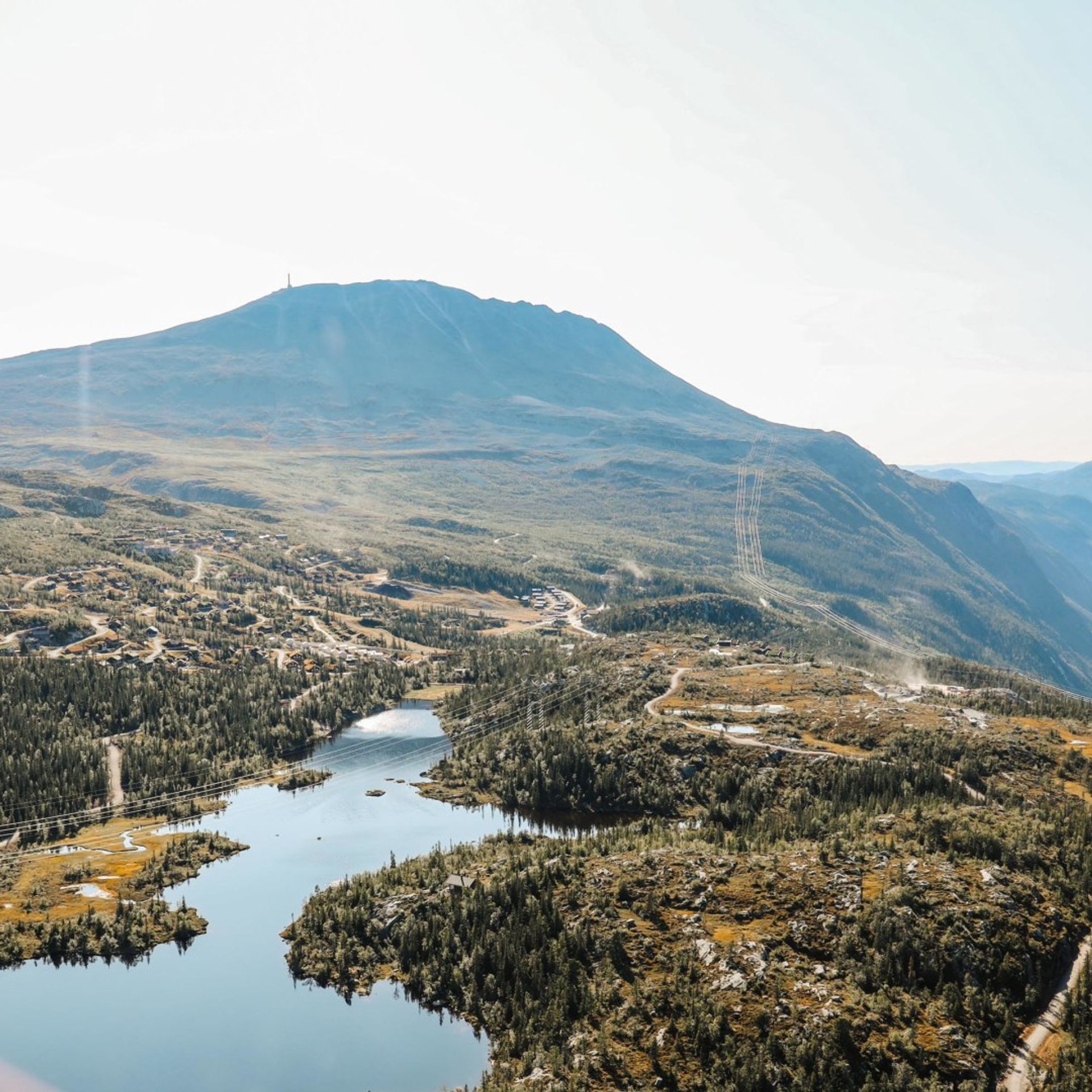
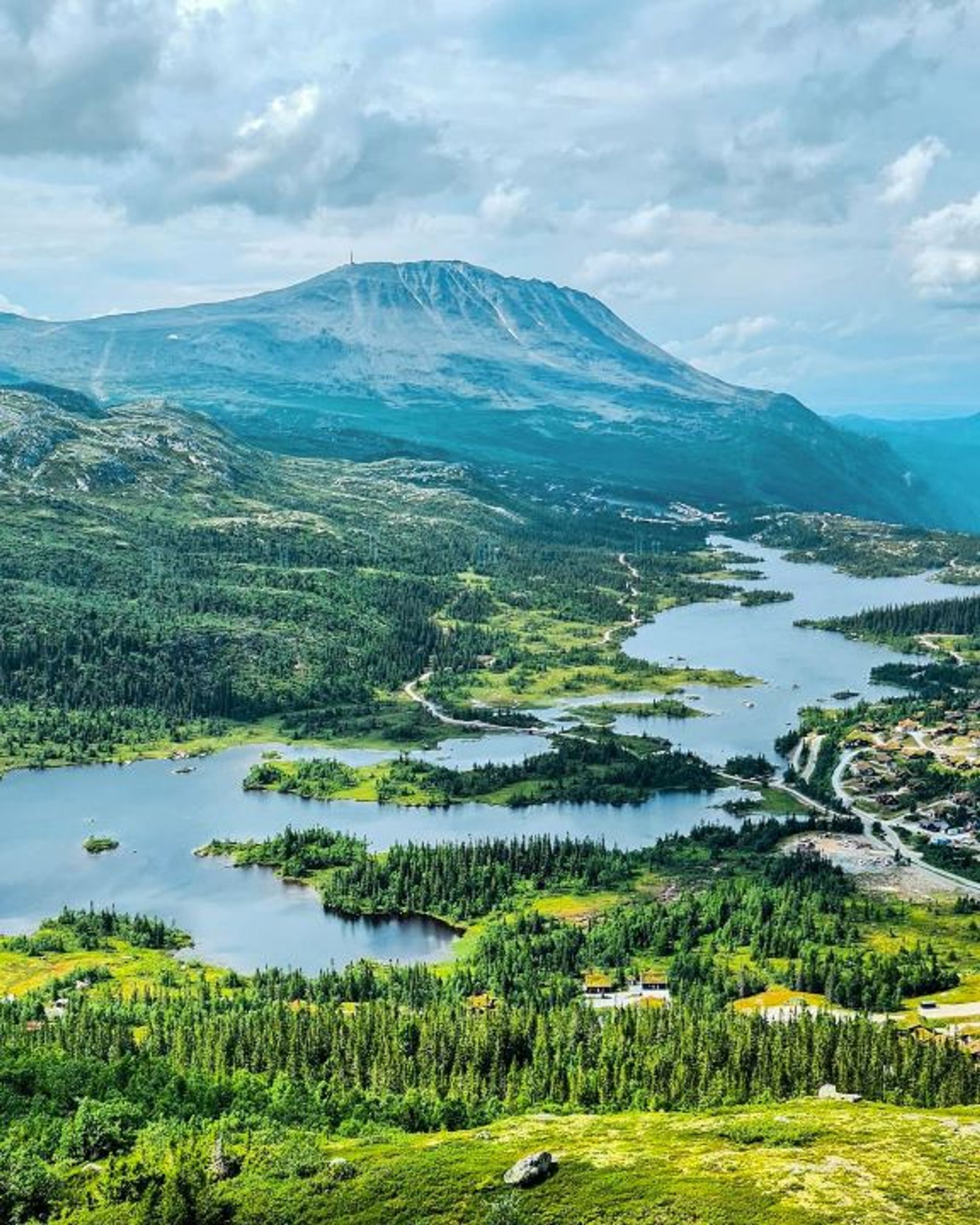
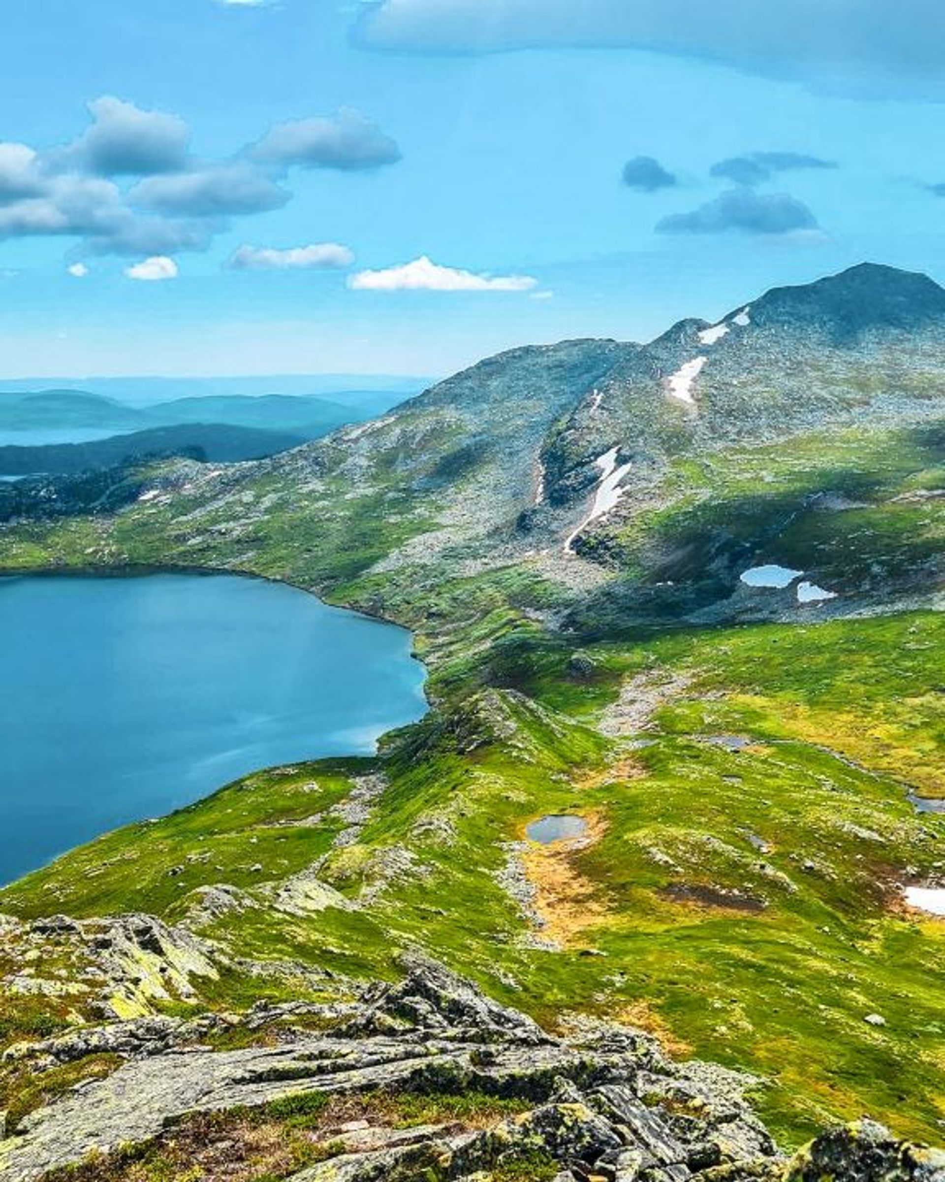
Toreskyrkja is a mountain situated between Lake Kvitåvatn, Gaustablikk, and Lake Heddersvatn. It’s 1,371 metres high, so not as high as the nearby Gaustatoppen, but this mountain-top hike from Vatnedalen/Lake Kvitåvatn is actually more challenging than the trail to Gaustatoppen from Stavsro .The hike starts at an altitude of 928 metres at Vatnedalen/Kvitåvatn and takes you all the way to the summit of Toreskyrkja.

Getting around
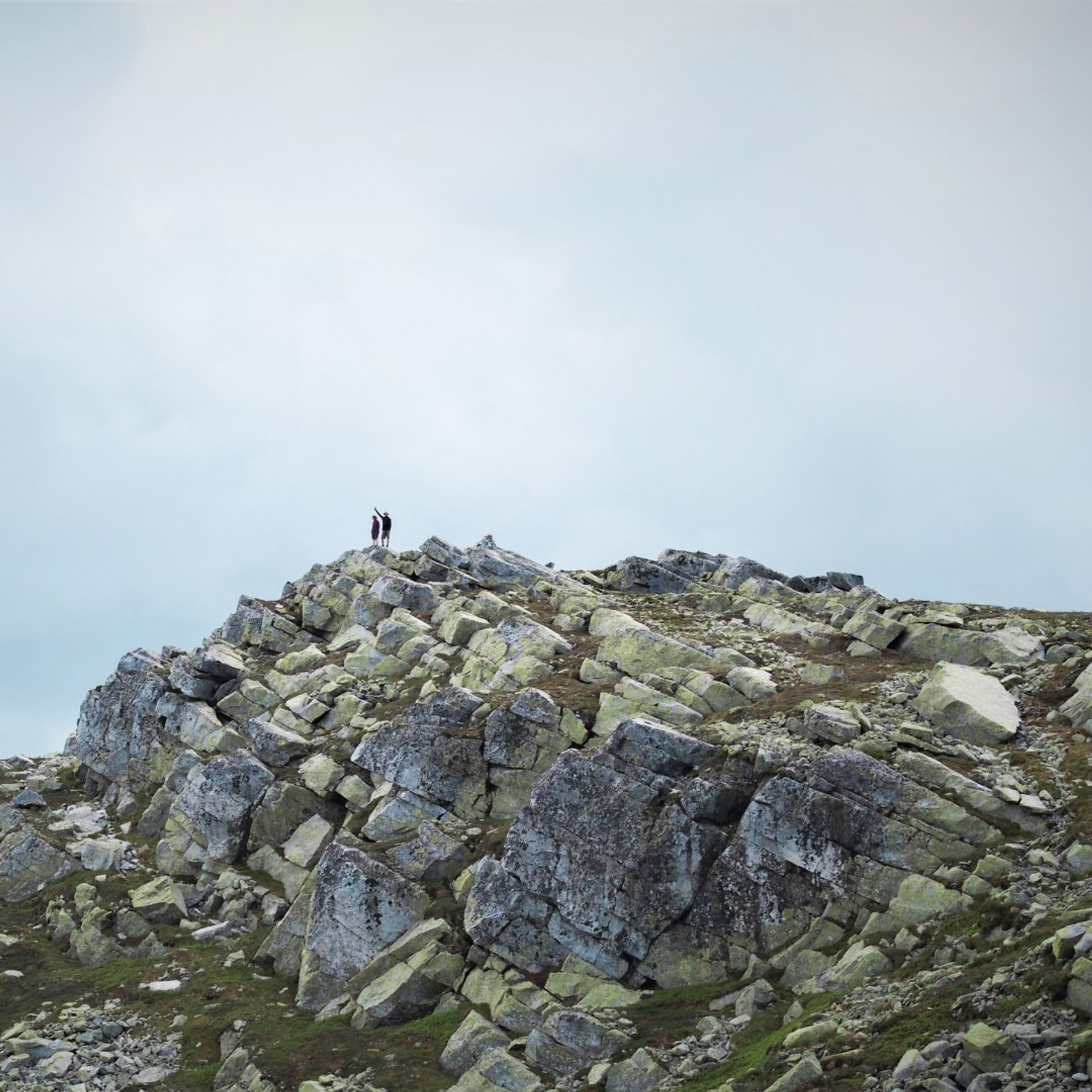
Start the hike at Kvitåvatnvegen road in Vatnedalen. From here take the signposted trail towards the top of Toreskyrkja. Follow the red ‘T’s and start the 400-metre steep ascent to the summit!
The hike to the summit is around 3.1 km and takes around 2 hours (one way). After the climb, a reward awaits you: from the summit you can enjoy spectacular views of Gaustatoppen, Tuddal, and the mountains in southern Telemark.

Useful information
The best time to do this hike from Vatnedalen/Lake Kvitåvatn to Toreskyrkja is in the summer and autumn months. The hiking season usually begins in early June and runs until the end of October.
The hike is demanding and is for people who are relatively used to hiking in the mountains. The mountain-top hike from Vatnedalen/Lake Kvitåvatn takes around 4 hours (there and back) and the total vertical rise is over 400 metres. This means it is not suitable for children or beginners. For an easier hike to Toreskyrkja, check out the hiking trail from Lake Heddersvatn.
The trail from Vatnedalen/Lake Kvitåvatn to Toreskyrkja is rocky and has sections with loose boulders, so make sure that you wear sturdy hiking shoes or hiking boots that support your feet and ankles.
Hikes on Gausta
Skipsfjell is the name of the mountain located in the middle of Gausta. It has one of the best viewpoints in the area. From the top at 1088 metres above sea level, you can enjoy magnificent views of the entire Gausta area, including Gaustatoppen, Kvitåvatn and Rjukan. Hiking up here (or around the whole mountain) is suitable for all ages and takes a few hours.
Ørnenipa is a popular mountain in Vatnedalen, located in the northeastern part of Gausta. The peak is located at 1315 metres above sea level and offers good hiking and beautiful views of Gaustatoppen the Gausta area. The popular trail from Vatnedalen takes about 4 hours (round trip).
This moderate hike to Toreskyrkja starts at Lake Heddersvatn next to Stavsro. The hike is 3,6 km and approximately 1–1,5 hours long (one way).
This challenging hike takes you from Vatnedalen to Toreskyrkja at 1,371 metres above sea level. At the summit you can enjoy spectacular views of Gaustatoppen, Tuddal, and the mountains in Telemark.
On the mountain crest south of Gaustatoppen you'll find Lille Gaustakne. The hike takes around 2 hours return, and from the summit at 1.443 metres you can enjoy magnificent views.

Remember
Dress appropriately and follow the Norwegian mountain safety code, which is a set of rules and advice that you should always have with you when you go out in the mountains. For example, make sure that you always plan your hike carefully and be prepared for bad weather and the cold, even on short hikes.

Download the Gausta app
Would you like to download the map to your phone? Download the Gausta app from App Store or Google Play! The app also has plenty of other useful information for your visit to Gausta.